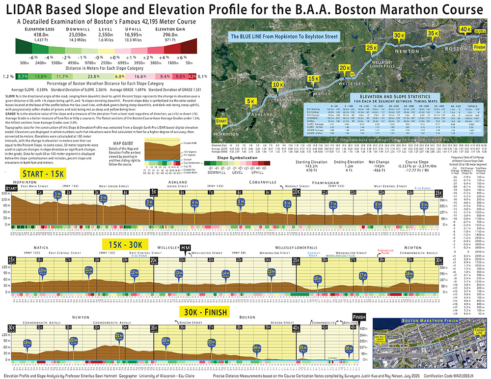
A week before the annual Patriot’s Day running of the B.A.A. Boston Marathon, retired UW-Eau Claire Geography Professor Sean Hartnett has produced a new generation of elevation and slope profiles of the famously hilly 42.195 kilometer, or 26.2-mile course.
This high-definition LIDAR (“light detection and ranging”) based topography data in Google Earth – is best evidenced with the appearance of 3D trees – and has facilitated the construction of a new generation of elevation profiles that also tracks slope data. Professor Hartnett constructed the current Boston Marathon profile in 2006 utilizing data collected with a high-end Trimble ProXR GPS that proved more accurate than available topographic maps, and actually holds up well when compared with the LIDAR elevations.
The LIDAR data is accurate enough to capture that the starting line across East Main Street in Hopkinton actually slopes slightly to the north, dropping from 470’ to 469’.… CLICK TO READ MORE.
